Understanding the intricate dance of weather and climate relies heavily on meticulous data collection and sophisticated analysis. This intricate process, encompassing a vast network of instruments and complex computational models, allows us to predict future weather patterns and comprehend the evolving climate. This article will delve into the methods employed to gather and interpret this vital information.
Initial Observations: The Foundation of Knowledge
Fundamental to weather forecasting and climate modeling is the initial collection of observations. This stage sets the stage for subsequent analysis and relies on a global network of instruments deployed strategically across various environments. Ground-based stations, strategically positioned across landmasses, provide crucial data regarding temperature, precipitation, humidity, wind speed and direction, atmospheric pressure, and cloud cover. These stations employ a variety of sensors, including thermometers, rain gauges, anemometers, and barometers, to record these measurements.
Sea-based observations are equally vital. Ships and buoys, drifting or anchored, collect data on ocean surface temperature, salinity, wave height, and wind speed and direction. This crucial maritime data helps understand ocean currents, which play a significant role in global climate systems. Additionally, airborne platforms, such as weather balloons and aircraft, provide vertical profiles of temperature, humidity, and wind. These platforms, equipped with sophisticated instruments, offer a detailed view of the atmosphere’s composition and structure.
Satellite Observations: A Global Perspective
Satellite technology has revolutionized our ability to observe weather systems globally. Orbits positioned high above the Earth, satellites can track and monitor cloud formations, precipitation patterns, and temperature distributions with unprecedented coverage. Various satellite instruments are designed to perceive different aspects of the atmosphere. For instance, some satellites measure infrared radiation emitted by the Earth, helping us discern temperature profiles. Other satellites measure microwave radiation, a crucial tool for observing cloud properties and precipitation. This global vantage point offers a holistic perspective on atmospheric phenomena and allows scientists to identify and track storms, cyclones, and other weather patterns over vast areas. The combined data from satellite sensors and ground-based stations creates a more comprehensive and detailed picture of the overall weather system.
Automated Weather Stations: A Network of Information
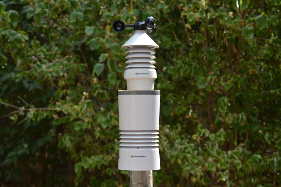
Automated weather stations act as vital nodes in the network of weather data acquisition. These stations, often deployed in remote or inaccessible locations, automatically collect and transmit data, reducing the need for manual observations. This automation ensures regular and consistent data collection, a crucial aspect of comprehensive weather analysis. This data is then disseminated, allowing meteorologists worldwide to access and use this essential information.
Data Processing and Analysis: Transforming Raw Information
Collected data is not readily usable; it needs meticulous processing and analysis before it can inform forecasts and provide insights into climate patterns. Firstly, data from various sources must be harmonized. Satellite data must be calibrated and adjusted to ensure accuracy. Likewise, data from ground stations and buoys must be validated and corrected for any errors or inconsistencies. This procedure ensures the reliability and consistency of the dataset.
Mathematical models are indispensable in transforming raw data into meaningful insights. Numerical weather prediction models use complex equations to simulate atmospheric processes. These models take account of variables such as temperature, pressure, humidity, and wind to project future weather scenarios. By incorporating historical data and sophisticated algorithms, these models provide forecasts for hours, days, and even weeks ahead.
Climate modelling, another critical application, explores long-term atmospheric patterns and the influences that shape them. This type of modelling delves into the complex interactions between the atmosphere, oceans, land surfaces, and ice sheets. By incorporating various factors, such as greenhouse gas concentrations, solar activity, and volcanic eruptions, scientists can simulate past climate conditions and project future scenarios.
Data Visualization and Interpretation: Unveiling Patterns
Visual representation of collected data is essential for comprehension. Weather maps and graphical representations provide a visual overview of temperature, precipitation, wind patterns, and other meteorological parameters. Data visualization tools allow meteorologists to identify patterns, trends, and anomalies, leading to insightful interpretations and improved understanding of climate phenomena. Graphs, charts, and specialized software programs aid in visualizing these patterns, facilitating efficient analysis and conveying the findings in a digestible manner to the public and scientific communities.
Validation and Refinement: Ensuring Accuracy
The quality and reliability of weather data hinges on meticulous validation and refinement. Models are continuously refined to improve their accuracy and predictive capabilities. Data collected from various sources are cross-referenced and validated against known or similar events to enhance the reliability of the data. This meticulous approach ensures that the analyses are based on robust and dependable data.
Conclusion: A Comprehensive Understanding
The accumulation and analysis of weather data is a complex and multifaceted process, a continuous process of learning and refinement. From the ground and sea to the stratosphere, a global network of instruments, satellites, and automated stations capture and transmit invaluable data. This data, after meticulous processing and analysis using sophisticated models, reveals crucial patterns and allows us to understand weather systems and climate trends. This integrated approach, embracing observational data, sophisticated modeling techniques, and rigorous validation methods, ultimately provides crucial insight into the Earth’s dynamic atmosphere, empowering us to predict future weather and prepare for climate change.
